
ONLY official information sources should be used for flight and flight planning (Greek AIP and current NOTAMs) and it is clearly mentioned on the maps that “For a safe and legal flight preparation, flight planning and for navigation through the flight, always consult the latest valid NOTAMs and the latest version of the AIP Greece”.
It is a practical tool from pilots to pilots, to help flying better, easier and safer within ATHINAI FIR under VFR.
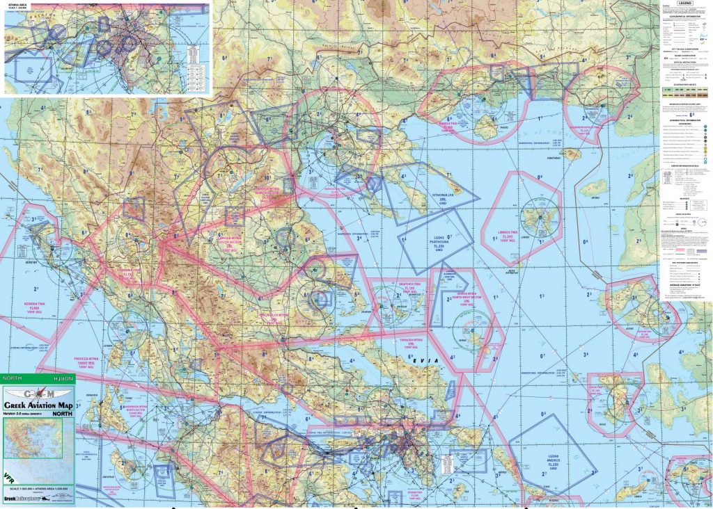
The maps (North and South) are based on the geographical background produced by Anavasi Editions with the most useful ground visual references for VFR flight (such as highway, high tension power lines, dam… ) as depicted on the Topography of Greece 2014.
On top of the above, there is the addition of more than 3.000 different aeronautical information based on the latest edition of the AIP Greece (see effective date of the chart).
Like sectional charts, the scale is 1:500.000 and standard plotter or navigation tools can be used.

Two versions are available:
The Standard version (special fiber reinforced paper and waterproof) and the Plastic version (same paper of the Standard version, with plastic film protection).
In case of special use or to be put on a wall, we can also provide it as a one piece wall chart with metallic supports on top and bottom (appropriate for operational room/air club briefing rooms).
For information, just fill out the form below with your details and we will contact you shortly with more details.
