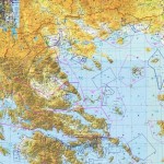
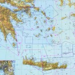
All started when we used to draw with black blue and red pen on aeronautical maps of Greece all the information required to safely fly within Athens FIR (the ones which we were using to find on US charts or West Europe charts).
Then we developed it into a digital version, and we thought that we should not keep it just for our personal use but make it available for other pilots flying VFR within the Athens FIR to cover a missing essential tool for safe flight preparation and planning.
It made it even more important to make it available to other pilots specially now that the NOAA (USA) is not any more (since 2009) printing the only VFR charts covering Greece (TPC G-3A, G-3B, G-3C, G-3D, F-3D), and until some official source will eventually produce it.
On those maps (one for North of Greece and one for South at 1:500.000) you will find:
- Airports with radio frequencies, RWY and field elevation,
- Official Heliports with elevation and radio frequencies for lighting system
- TMAs and MTAMs
- CTRs
- ATZs
- VFR routes for Athens, Thessaloniki, Kerkira, Samos, Rhodes, ….
- VOR and NDB codes and frequencies
- Special use airspaces: Danger, restricted and prohibited with code identification and names.
We have divided the map in such a way that Athens area is in both maps. We plan to produce two versions: Standard (photo quality paper) and Plastic (photo quality paper with a very thin plastic film protection) .
The Standard map is easier to fold, lighter and cheaper and the Plastic map is well protected to last longer.
We are strongly insisting that this is NOT an official tool for navigation and flight planning, ONLY official sources should be use (Greek AIP, Jeppesen, current NOTAMs, …) for flight and flight planning.
It is just a practical tool from pilots to pilots, to help flying better, easier and safer.
We are looking forward for comments, corrections or improvements and we are planning to continually improve it and we will try to keep it as current as possible.
Get yours Here!


